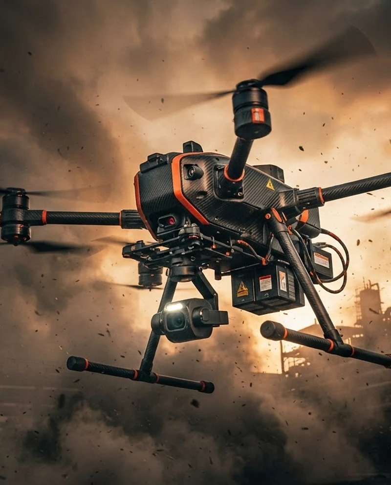
Heavy-lift inspection drone hovering in smoke and wind at golden hour
● LAT: 37.7749°NLON: 122.4194°WALT: 342mSPD: 12.4 m/sHDG: 287°BAT: 78%TEMP: 18°CVIS: 8.2 kmWIND: 14kt NW● MISSION ACTIVEGPS: 18 SATSLINK: 2.4GHz
PRECISION-FIELD PROTOCOL // ACTIVE

INTELLIGENCE
WHERE HUMANS
CAN'T REACH.

We deploy certified drone operations across search & rescue, critical infrastructure, and construction intelligence — delivering mission-grade aerial data when seconds and precision matter most.

LIVE TELEMETRY
REC
STATUS
AIRBORNE
SECTOR
SAR-04 / WIND-02
ALTITUDE
342m AGL
WIND
14 kt NW
BATTERY
78%
SIGNAL
STRONG
ACTIVE MISSIONS: 03
SCROLL TO DEPLOY
SECTOR MATRIX / 02

CAPABILITIES
ACROSS ALL TERRAIN.

Seven operational sectors covering humanitarian, infrastructure, security, and development missions. Each deployment is staffed by certified pilots and equipped with sensor payloads matched to your objective.
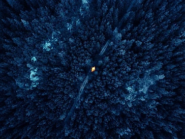
Thermal infrared scan of a forest showing the heat signature of a lost person
HUMANITARIAN
THERMAL / FLIR
SEC-01

Search & Rescue

Thermal and RGB aerial search operations for missing persons, disaster zones, and emergency response coordination.
Thermal Person DetectionArea Grid SearchLive Video DownlinkNight Operations
REQUEST THIS SECTOR
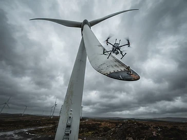
Inspection drone hovering near a wind turbine blade under overcast sky
INFRASTRUCTURE
RGB / POINT CLOUD
SEC-02

Wind Farm Monitoring

Blade inspection and structural assessment of wind turbines using high-resolution imaging and 3D modeling.

Blade Surface InspectionLeading Edge DamageLightning Strike Audit3D Point Cloud
REQUEST THIS SECTOR
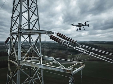
Aerial view of high-voltage powerline insulators being inspected
INFRASTRUCTURE
THERMAL / RGB
SEC-03

Powerline Monitoring

High-voltage transmission line inspection with thermal anomaly detection and vegetation encroachment analysis.

Hotspot DetectionInsulator AuditVegetation ClearanceCorridor Mapping
REQUEST THIS SECTOR
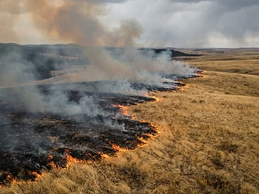
Aerial view of an active grassland wildfire with flames and smoke across dry grass
HUMANITARIAN
THERMAL / RGB
SEC-04

Mitigation Fire Watch

Prescribed burn observation and active fire perimeter tracking with real-time aerial oversight and thermal hotspot detection.

Burn Perimeter TrackingHotspot DetectionSmoke Plume MappingHazard Monitoring
REQUEST THIS SECTOR
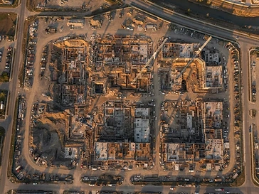
Top-down aerial view of a construction site at golden hour
DEVELOPMENT
RGB / 3D MESH
SEC-05

Construction Reports

Progress tracking, volume calculations, and site documentation delivered as survey-grade orthomosaics and 3D models.

Progress DocumentationEarthwork VolumesSite OrthomosaicsCut/Fill Analysis
REQUEST THIS SECTOR
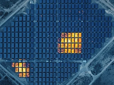
Aerial thermal infrared scan of solar panels revealing heat signature hotspots
INFRASTRUCTURE
THERMAL / RGB
SEC-06

Solar Panel Inspection

Cell-level defect detection and thermal hotspot mapping across photovoltaic arrays using high-resolution imaging and infrared anomaly analysis.

Hotspot DetectionCell Defect MappingString Performance AuditOrthomosaic Survey
REQUEST THIS SECTOR
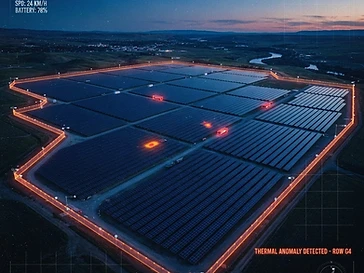
Aerial surveillance view of a vast solar farm at dusk with thermal perimeter scan
SECURITY
THERMAL / NIGHT
SEC-07

Solar Farm Security

Perimeter surveillance and intrusion detection across large-scale solar installations using automated patrol flights and live thermal downlinks.

Perimeter PatrolIntrusion DetectionThermal SurveillanceNight Watch
REQUEST THIS SECTOR
500+
MISSIONS DEPLOYED
12,000+
FLIGHT HOURS
98.6%
DATA ACCURACY
< 2hr
RESPONSE TIME
COMING SOON / 2026

DRONE DOGS:
WHERE THE AIR CAN'T REACH.

Expanding the fleet from the air to the ground. Quadruped ground platforms that go under canopy, into rubble, and through confined spaces — extending our search, rescue, and mapping capability to the places a drone simply can not fly.

DEVELOPMENT STAGE
In field trials — expect operational rollout mid‑2026.
Ground Search & Rescue
GND‑01
GROUND SEARCH & RESCUE
FIELD TRIAL

Autonomous quadruped sweep of dense bush, collapsed structures, and terrain an aerial asset can not see under canopy — feeding thermal contacts and last‑known positions back to SAR command in real time.

SENSOR LOADOUT
Radiometric thermal headRadio direction‑findingTwo‑way hailerGNSS tracking
STATUS: PRE‑OPNOTIFY ON LAUNCH
Ground Mapping
GND‑02
GROUND MAPPING
FIELD TRIAL

LiDAR‑grade mobile scanning from under tree cover and inside infrastructure — dense ground point clouds and orthomosaics for flood modelling, heritage survey, and hard‑to‑reach confined spaces.

SENSOR LOADOUT
Mobile LiDAR scannerRGB photogrammetryRTK GNSSIMU telemetry
STATUS: PRE‑OPNOTIFY ON LAUNCH
4‑LEGGED
QUADRUPED PLATFORM
CANOPY
UNDER‑COVER ACCESS
LIDAR
GROUND POINT CLOUD
2026
TARGET ROLLOUT
MISSION REPORT / 03

PROOF OF
EFFICACY.

Every mission produces a deliverable-grade report. Below is a declassified case study from a multi-vehicle highway incident mapping operation.

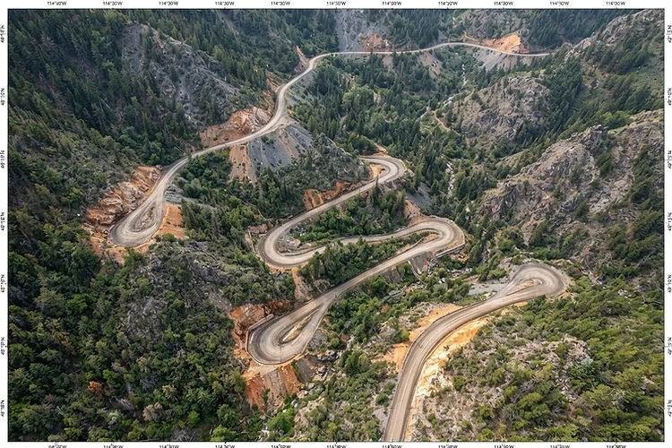
High-resolution aerial orthomosaic survey of a rural road with mapping coordinates
CASE FILE
HWY-04 / RT-2026-0891
CAPTURED
14:32 UTC
ORTHO READY
1.2 cm/px
REQUEST SIMILAR REPORT
MISSION BRIEF

Emergency services requested aerial mapping of a multi-vehicle collision on a rural highway. The objective was to produce an evidence-grade orthomosaic and 3D scene reconstruction within 90 minutes of dispatch — enabling insurance assessment, traffic management, and lane reopening without prolonged road closure.

EQUIPMENT
DJI Matrice 350 RTK
Zenmuse H30T Payload
01
FLIGHT TIME
42 minutes
3 battery rotations
02
DATA POINTS
847 images
2.3 GB raw capture
03
RESOLUTION
1.2 cm/px
GSD orthomosaic
04
DELIVERABLE
Orthomosaic + 3D Mesh
Web share + GIS export
05
DELIVERABLES PACKAGE
Orthomosaic (TIFF)
3D Point Cloud
Scene Video (4K)
GIS Shapefiles
Flight Log (CSV)
Analysis Report (PDF)
DISPATCH / 04

BUILD A
FLIGHT PLAN.

Tell us your terrain, objective, and urgency. We'll assemble the right aircraft, sensor payload, and pilot — then deploy.

FLIGHT PLAN BUILDER
01
TERRAIN
02
OBJECTIVE
03
URGENCY
04
CONTACT
EST. RESPONSE
SCHEDULED

Select Your Terrain

Where will the mission take place?

STEP 1 OF 4
base44
Edit with Base44